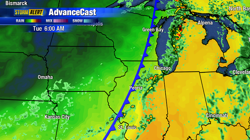
Weather map showing a cold front approaching Chicago. Photo by Heart of Illinois ABC. (click to see the larger version)
We’ve been experiencing unseasonably mild conditions for most of October, with intermittent rain and south or east winds. It’s felt more like April or May and this pattern is forecast to continue into the middle of the month. These are poor conditions for fall migration. When October comes, birders look forward with eager anticipation to cold fronts and west winds, ideal conditions that bring large numbers of migrants south. A cold front is the leading edge of a colder air mass that originates to the north of us. The graphic illustrates what a cold front looks like on a weather map – a blue, curved line with small triangles that look like teeth. Migrants ride these cold fronts south out of Canada. If you’ve been to Montrose in the last week you’ve probably noticed how flat it feels. We are getting migrants, but not big numbers of birds we should be seeing now, like Yellow-rumped Warblers and White-throated Sparrows. At some point this pattern will break and things will change. Being a birder means waiting a lot for something to happen.